
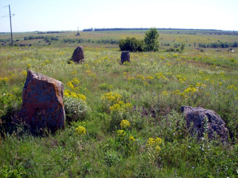
The Ukrainian Boundary Stones are an archaeological monument of Ukraine from the late Neolithic era. The monument consists of two rows of 15 pairs of parallel stone monoliths – a menhir alley.
Perhaps it is a religious site associated with the sun god. The rows are oriented from east to west, the height of the parallel pairs of boulders is the same. The highest is the second pair (up to 1.50 m), the height of the next one gradually decreases. The distance between adjacent blocks of the rows increases. No qualified archaeological research has been conducted at the site.
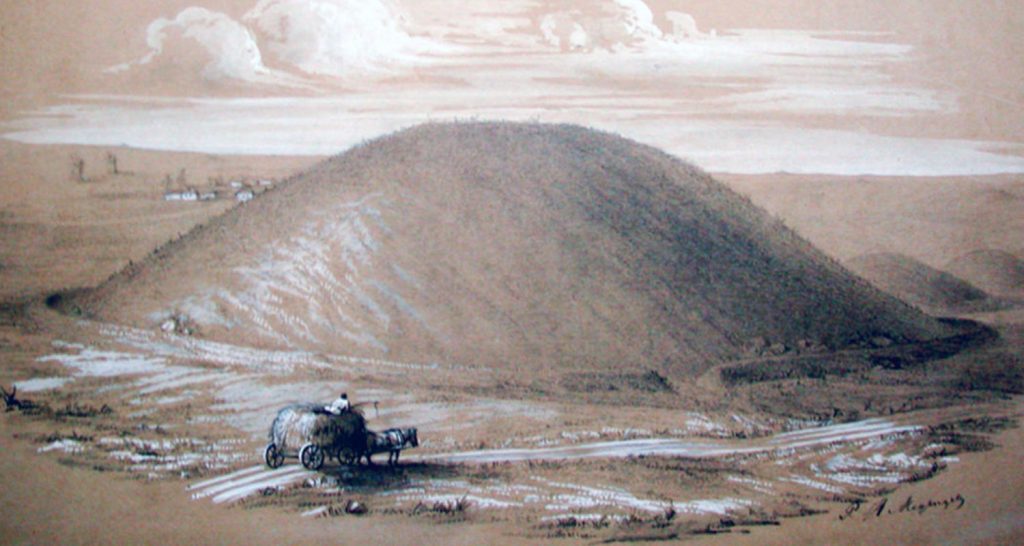
Within a radius of 1-2 km from the “Ukrainian boundary stones” there are about 20 burial mounds (Neolithic / Bronze Age), many of which have been destroyed. The Ukrainian Boundary stones are located near the confluence of the Sugakleya and Sugakleychik rivers, south of Nechaevka village, Kompaneevsky district, Kirovograd region (Ukraine).
